


QField for QGIS

QField for QGIS açıklaması
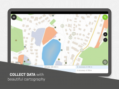
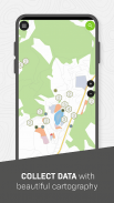
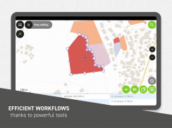
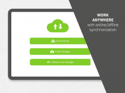
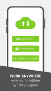
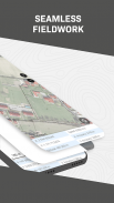
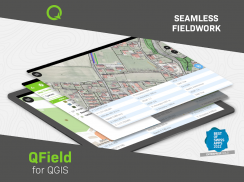
QField, GIS saha çalışmasının verimli bir şekilde yapılmasına ve saha ile ofis arasında rahat ve kullanıcı dostu bir şekilde veri alışverişine odaklanmaktadır.
QField, kurumsal kategoride prestijli İsviçre Uygulamalarının En İyisi Ödülü 2022'yi kazandı.
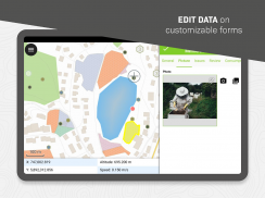
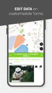
Popüler QGIS açık kaynak projesi üzerine inşa edilen QField, kullanıcıların sahada tamamen yapılandırılmış projeleri tüketmesine olanak tanıyarak özelleştirilmiş özellik formlarına, harita temalarına, yazdırma düzenlerine ve daha fazlasına olanak tanıyarak QGIS'in gücünü parmaklarınızın ucuna getirir.
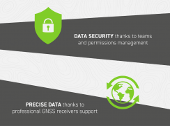
Gdal, SQLite ve PostGIS gibi açık kaynaklı kitaplıklardan yararlanan QField, çok çeşitli uzamsal vektör ve raster veri kümelerini okur, görüntüler ve düzenlenmesine olanak tanır. Kullanıcılar, ister cihazınıza indirilmiş, ister e-postalarda paylaşılmış, ister USB kablosuyla aktarılmış olsun, veri kümelerini nerede olurlarsa olsunlar görüntüleyebilir ve değiştirebilirler.
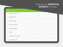
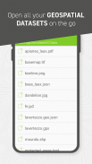
Desteklenen formatlar şunları içerir:
- QGIS proje dosyaları (.qgs, .qgz ve ayrıca geopackage gömülü projeler);
- SQLite tabanlı coğrafi paket ve mekansal veritabanları;
- GeoJSON, KML, GPX ve şekil dosyası vektör veri kümeleri;
- GeoTIFF, Jeo-uzaysal PDF'ler, WEBP ve JPEG2000 raster veri kümeleri.
Eksik yetenekleri mi arıyorsunuz? OPENGIS.ch yeni özelliklerin uygulanmasına yardımcı olmaktan mutluluk duyar. Bize https://www.opengis.ch/contact/ adresinden ulaşın.
İzinler
---
QField, mekansal projelerin ve veri kümelerinin üzerine cihaz konumunu kaplayan bir işaretleyici çizmek için konum iznini kullanabilir. QField ayrıca veri girerken enlem, boylam, yükseklik ve doğruluk gibi konum ayrıntılarını görüntüleyebilir ve kullanabilir.
Notlar
---
Hata raporları için lütfen https://qfield.org/issues adresinden bir sorun bildirin.
QField for QGIS - Sürüm 3.4.7 - Ebo
(13-12-2024)
QField for QGIS - APK Bilgisi
APK sürümü: 3.4.7 - EboPaket: ch.opengis.qfieldQField for QGIS uygulamasının en son sürümü
Diğer sürümler


 3.55
3.55
 3.17
3.17


Aynı kategorideki uygulamalar


Hoşuna gidebilecekler...


